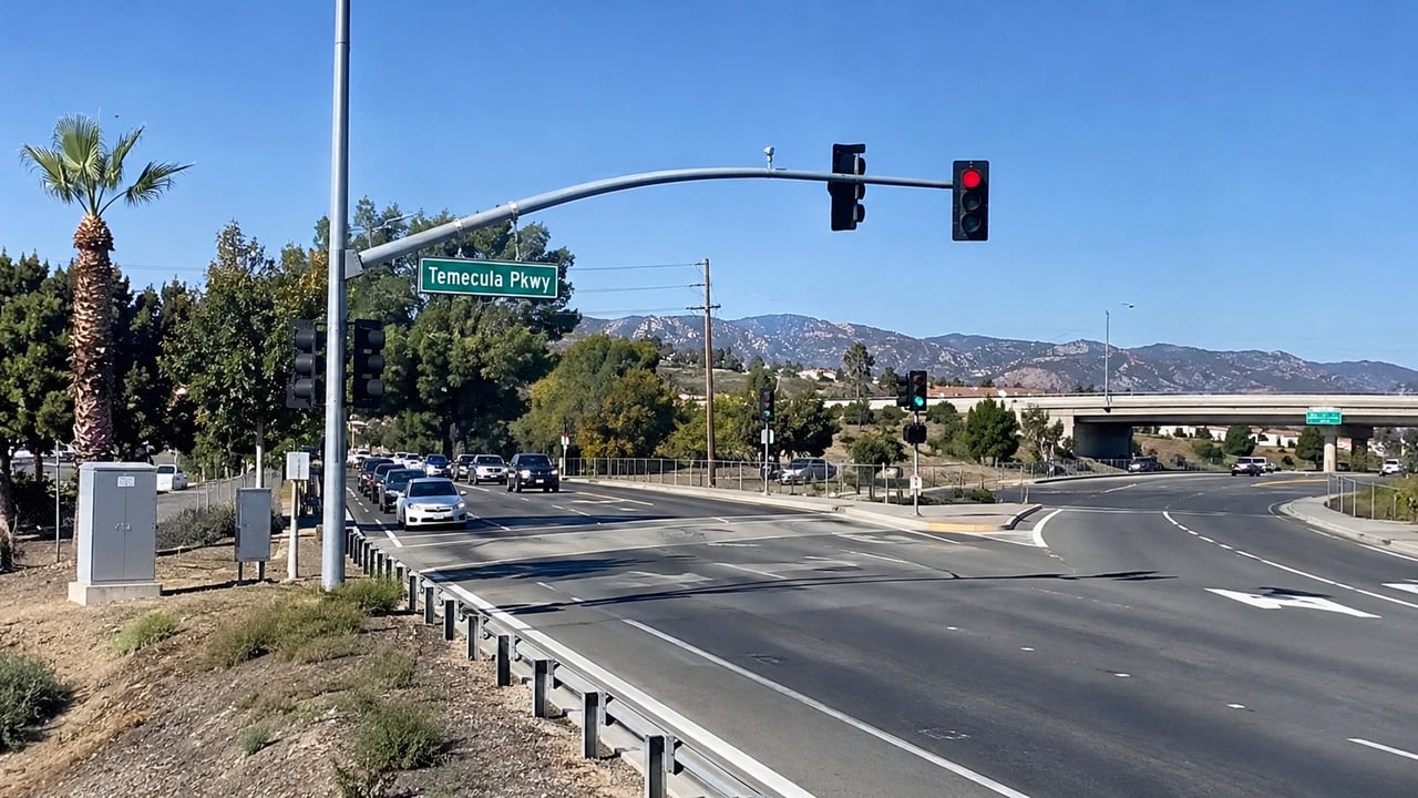
If your drive from Paloma Del Sol starts on the northbound 15 at Temecula Parkway, that on-ramp changed this year. It now has a three-lane meter, and the signal sits closer to the freeway than before so the ramp can hold more cars. The lane that used to be for carpools is now open to everyone.
At peak hours, the light works like this:
- A flashing yellow beacon comes on when the meter is running or about to start. Slow down and be ready to stop.
- All three lanes turn red at the same time and green at the same time.
- The sign at the stop line sets the rule for each lane.
ONE CAR PER GREEN, EACH LANE
The signal is easy to treat as a speed bump between you and the freeway. It is actually one piece of a coordinated experiment that runs from the county line to Murrieta. The few seconds you sit there are what that experiment is trading for a steadier freeway, and the results are posted where any driver can see them.
The bottleneck is the on-ramps
The Riverside County Transportation Commission runs the I-15 Smart Freeway pilot with Caltrans, the Western Riverside Council of Governments and the City of Temecula. RCTC's project page explains why the northbound 15 jams up between the San Diego/Riverside county line and the I-15/I-215 interchange in Murrieta. The cause is the large number of cars entering at three on-ramps: Temecula Parkway, Rancho California Road and Winchester Road. It is worst in the afternoon and evening.
So Temecula Parkway is one of the three places where the northbound freeway fills up, and the other two are farther along the same stretch. When all three ramps let cars on in bursts at peak hour, the main lanes slow to stop-and-go. The pilot covers an eight-mile stretch with no tolls. Sensors track traffic on the freeway itself, and the three ramp meters act as one system, letting more or fewer cars on as conditions change.
RCTC's page says the meter "is not meant to hold drivers on the ramp." Its job is to control how many vehicles join I-15 at once. Sensors watch both the freeway and the line of cars on the ramp, and the signal timing changes as either one changes. So the length of your wait depends on more than Temecula Parkway. It also depends on what is happening on the freeway ahead of you and at the other two metered ramps.
Three ramps, three setups
The meters work together, but each ramp is built differently. If your routine sometimes takes you to Rancho California Road instead, this is what you will find there.
On-ramp, northbound I-15 | Meter setup | Driver detail |
|---|---|---|
Temecula Parkway | Modified three-lane meter | Meter moved closer to the freeway for more storage; former HOV lane now open to all drivers |
Rancho California Road | Loop and direct ramps merge at a three-lane meter | On the direct ramp, the shoulder can be used as a temporary lane only when a green arrow shows; a red X means it is closed |
Winchester Road | Two-lane meter approaches | Ramps striped for two lanes at the meter |
The Rancho California shoulder rule is the one most likely to surprise someone who doesn't use that ramp often. When the shoulder shows a red X, drivers have to stay in the regular lane and leave the shoulder empty.
Digital message signs along the northbound stretch show recommended speeds and current conditions. They are meant to keep traffic moving steadily and safely. RCTC calls them recommendations. The stretch is still a regular, non-tolled freeway.
What the sensors don't do
A light that decides when you can go, and roadside equipment that watches traffic, raises a fair question about what is being recorded. RCTC answers it directly. The system collects traffic-flow data only. It does not take photos, issue tickets or collect personal information.
That narrows what the meter can measure to counts, speeds and travel times. Those same measurements are what will decide whether the experiment worked.
The trade RCTC is testing
When RCTC announced the launch, it said the three coordinated meters would run during peak hours. It also said drivers might wait a little longer at on-ramps in exchange for better overall travel time on the freeway. The project page puts it the same way: drivers "may initially experience short delays at on ramps," and the expected payoff is time savings overall, fewer stops and a smoother drive through the corridor.
Some drivers doubted this before it started. Ahead of the launch, the Press-Enterprise spoke with a Murrieta commuter who doubted that technology would help as much as more lanes would. That is the question the pilot is set up to answer. RCTC switched the system on Monday, June 1, 2026, and the pilot runs for two years. During that time, RCTC and Caltrans will measure its effect on congestion and decide whether the approach should be used elsewhere in California.
The project has been in the works for a while. RCTC started looking at smart-freeway technology in 2019. Studies and design took place in 2023 and 2024, and construction began in January 2025. At the June activation, RCTC reported $33 million in secured funding: $27 million federal, $1 million state and $5 million in congressional Community Project Funding.
The scoreboard is public
The pilot posts its results online. On September 30, 2026, RCTC relaunched its online Smart Room at smartfreeway.org with a performance dashboard. RCTC says the dashboard is there so residents can follow how the system performs throughout the two-year pilot.
As of RCTC's September 30 announcement, the dashboard included vehicle throughput, meaning how many vehicles get through, and travel time. RCTC said it would add more performance indicators as it collects more data. The dashboard also includes a glossary that explains each term and how to read the data. The Smart Room also has a virtual tour of where the pilot operates, FAQs, project updates and videos.
Those two measures connect to two different experiences. Throughput is about the freeway as a whole. Travel time is about your own drive, from the moment you leave the ramp to the moment you reach Murrieta. A slightly longer stop at Temecula Parkway pays off only if the travel-time line moves in the right direction. That is the number to check.
The pilot also gets reviewed in public. RCTC's October 14, 2026 Commission agenda included an update on the Smart Freeway pilot, with a presentation for commissioners to receive and file. Commission agendas are posted on RCTC's website, so those updates are available to anyone who follows the project.
The rest of the corridor changed too
The meter is the newest change on this stretch of the 15, but not the only one. Two lane projects have also changed what happens after you leave the ramp and on the drive home.
Heading north, the City of Temecula's completed I-15 congestion relief project added a northbound auxiliary lane from the Temecula Parkway on-ramp to the Rancho California Road off-ramp. For a short trip to Old Town or the Rancho California shopping centers, cars from your ramp have their own lane for that one stretch instead of merging straight into through traffic.
Coming home, Caltrans's $33.8 million auxiliary lanes project adds connecting lanes on both sides of the freeway. Northbound, the new lane runs from Rancho California Road to Winchester Road. Southbound, the lanes run from Winchester Road to Rancho California Road and from Rancho California Road to Temecula Parkway. Caltrans says permanent striping was finished in September. Remaining electrical loop installation may still require night work on lanes and ramps through fall 2026. If you drive home late, check Caltrans District 8 notices before counting on a clear ramp.
So the Temecula Parkway interchange is now linked to the rest of the corridor in both directions. Northbound, its ramp is timed together with two others. Southbound, a new lane runs from Rancho California Road to the Temecula Parkway exit. The northbound meter is part of a two-year public test that began in June, with a dashboard that shows whether it is working.
Changes like this can affect how a home near Temecula Parkway compares with one closer to Rancho California or Winchester Road, and they often come up when sellers and buyers talk about commutes. If you're thinking about a move in or around Paloma Del Sol and want to talk about how these drives affect your plans, David Limon and the Your Home Selling Pros team are glad to help, in English or Spanish. Contact Us!